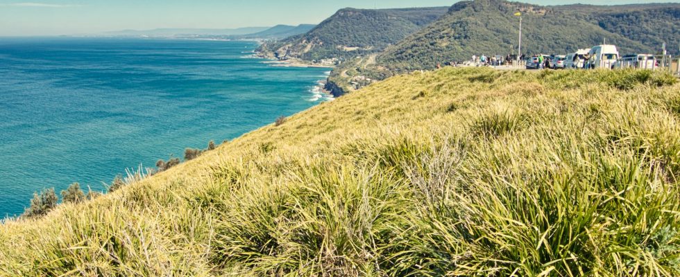
Stanwell Tops is another popular location where many riders in small and large groups travel through the Royal National Park.
The location looks over the beautiful coastline towards Clifton and the Sea Cliff Bridge.
Scorecard
- Difficulty – Experienced
- Duration – 42 mins
- Distance – 38 kms
- Average Speed – 58kph
- Max Speed – 80kph
The Ride
A good spot to meet up is at Loftus Oval just before Farnell Avenue off the Pacific Highway. There is ample parking that is available in this area where you can stop and wait for mates.
Once you meet up just head off onto Farnell Avenue which will take you into the Royal National Park. Depending upon the time of day there may be lots of traffic but generally bikes will use the left hand lane to go past the toll gate. If you are passing through then you are not required to pay any toll, otherwise you have to pay the toll.
Once you get passed the traffic you head down Audley Road. The road slopes downhill and eventually arrive at the crossing of Hacking River. There is a hairpin section as you reach the bottom of the hill, one should take care as sometimes drivers may over or underestimate this corner and may come over to your part of the lane.
You can take a few minutes to stop there and enjoy the location. It’s quite a serene and peaceful if there aren’t any crazy number of tourists/visitors.
After this, you head uphill Sir Bertram Stevens Drive which takes you up the hill. Riding along you eventually go through lush bushland which means some sections and corners may have damp surface or wet leaves on the road so you should take care as you find yourself in dense bushland.
Almost all the road is single lane on each side but there are broken sections where there is possibility for overtaking but if you get stuck behind a slow car you should be patient and don’t get frustrated. As one wrong move on your two wheels could hurt you more than anybody else on that road.
Stops Along the Way
Hacking River crossing is a good place to stop and have a break. The location is also great if you want to take some pictures with your friends. After this the next stop would be at Stanwell Tops (also called Bald Hill Lookout) as you finally come out of the the dense bushland only about a kilometer or two from final destination spot of Stanwell Tops Lookout. I have found that Stanwell Tops seems to be a more popular spot than the Stanwell Tops Lookout.
So you could decide to end your trip here as there is a nice cafe/restaurant here called the Flying High Cafe which serves some amazing Buffalo Wings.
Any Tricky Stuff
Once you are in the dense bushland of the Royal National Park you should proceed with caution through the winding roads as sections may be damp or wet or contain wet foliage which can cause your tires to skid if you are not approaching a corner in the right gear at the right speed.
Summary
This is a beautiful ride through the Royal National Park and certainly one that can be repeated many times throughout the year. So far I have been through this Royal National Park twice but its certainly a fun-filled experience.
The Map
Get directions on your phone by clicking this google map link.
Pingback: Smart Riding - Going Against the Traffic - Weekend Rider